Cinematographer
Lidar-Scans geben mir und dem VFX-Team exakte Daten über Sets und Locations. Das ermöglicht präzise CG-Integration und erspart aufwändige Messungen.
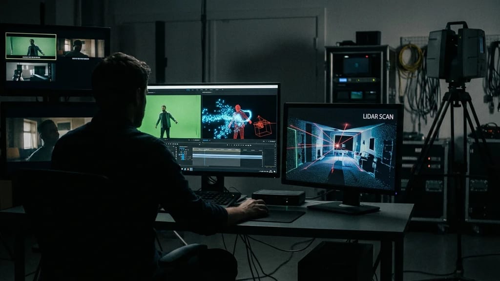
Light Detection and Ranging scanning – a survey technique using laser pulses to create precise 3D point cloud data of physical environments, used in film production for VFX set extensions, virtual production previz, accurate CG environment recreation, and photogrammetry reference.
Lidar Scanning (Light Detection and Ranging) is a surveying technique that uses laser pulses to capture precise 3D point cloud data of physical environments. In film production, it is used for VFX planning, set extensions, and virtual production.
| Aspect | Description |
|---|---|
| Technology | Laser ranging |
| Output | 3D point cloud |
| Accuracy | Millimeter-precise |
| Application | VFX, VP, Survey |
| Step | Description |
|---|---|
| Laser | Emits pulses |
| Reflection | From surfaces |
| Measurement | Time of flight = distance |
| Accumulation | Millions of points |
| Type | Description |
|---|---|
| Terrestrial | Tripod-based |
| Mobile | Handheld |
| Airborne | Drone/Aircraft |
| Vehicle-mounted | Vehicle-based |
| Manufacturer | Models |
|---|---|
| Faro | Focus, FreeStyle |
| Leica | RTC360, BLK |
| Trimble | TX8, X7 |
| Z+F | Profiler Series |
| Device | Description |
|---|---|
| iPhone Pro | LiDAR integrated |
| iPad Pro | LiDAR integrated |
| Faro Freestyle | Professional mobile |
| Leica BLK2GO | Wearable scanner |
| Application | Description |
|---|---|
| Set Extension | CG extends real set |
| Virtual Production | LED wall content |
| Previz | Virtual planning |
| Reconstruction | Recreate set digitally |
| Phase | Usage |
|---|---|
| Pre-Production | Location scan |
| Production | Set documentation |
| Post-Production | CG reference |
| QC | Verification |
| Aspect | Description |
|---|---|
| Format | Millions of 3D points |
| Data | XYZ + color/intensity |
| Size | GB to TB |
| Processing | Specialized software |
| Step | Description |
|---|---|
| Registration | Stitching scans together |
| Cleaning | Removing noise |
| Meshing | Generating surfaces |
| Export | For VFX software |
| Tool | Function |
|---|---|
| RealityCapture | Processing, Mesh |
| CloudCompare | Open Source Point Cloud |
| Faro Scene | Faro data |
| Autodesk ReCap | Processing |
| Software | Import |
|---|---|
| Maya | Alembic, FBX |
| Houdini | Point Cloud native |
| Nuke | 3D system |
| Unreal/Unity | Real-time |
| Technique | Combination |
|---|---|
| Photogrammetry | Texture + geometry |
| HDRI | Lighting |
| Survey | Control points |
| Motion Capture | Spatial calibration |
| Application | Description |
|---|---|
| LED Volume | Environment data |
| Camera Tracking | Spatial reference |
| Previz | Planning in engine |
| Art Department | Set design |
| Aspect | Procedure |
|---|---|
| Permission | Obtain authorization |
| Coverage | All relevant areas |
| Overlap | For registration |
| Documentation | Scan positions |
| Timing | Purpose |
|---|---|
| Before shooting | Reference |
| During shooting | Current documentation |
| After shooting | For post |
| Changes | For set modifications |
| Factor | Influence |
|---|---|
| Scanner quality | Millimeter range |
| Distance | Further = less accurate |
| Surface | Reflection varies |
| Overlap | More = better |
| Problem | Solution |
|---|---|
| Reflective surfaces | Spray/Avoid |
| Moving objects | Avoid/Mask |
| Large areas | Multiple scans |
| Data volume | Powerful hardware |
| Element | Factor |
|---|---|
| Equipment | Scanner rental/purchase |
| Operator | Specialized |
| Processing | Time + software |
| Output | Depends on scope |
| Role | Task |
|---|---|
| Scan Operator | Capture |
| Data Processor | Processing |
| VFX Supe | Requirements |
| Art Dept | Coordination |
| Output | Format |
|---|---|
| Point Cloud | E57, LAS, PLY |
| Mesh | OBJ, FBX, Alembic |
| CAD | DWG, if needed |
| Reports | Documentation |
| Practice | Reason |
|---|---|
| Scan early | More planning time |
| Sufficient overlap | Better registration |
| Scale reference | For verification |
| Document | Scan positions |
Lidar scanning has become a standard tool in VFX-heavy film production. From set extensions and virtual production to precise CG integration, the millimeter-accurate 3D data enables seamless blending of the real and virtual worlds. With mobile scanners like iPhone/iPad, the technology is more accessible than ever.
Lidar-Scans geben mir und dem VFX-Team exakte Daten über Sets und Locations. Das ermöglicht präzise CG-Integration und erspart aufwändige Messungen.
Mit Lidar-Daten kann ich Sets virtuell erkunden und Shots planen, bevor wir drehen. Für VFX-schwere Projekte ist das unverzichtbar.
Lidar-Scanning ist eine Investition in der Prep, die sich in der Post auszahlt. Präzise Daten bedeuten weniger VFX-Probleme und geringere Kosten.
1. Was beschreibt „Lidar-Scan / LiDAR-Vermessung / Laser-Scanning / 3D-Vermessung" am besten?
2. Zu welchem Department gehört „Lidar-Scan / LiDAR-Vermessung / Laser-Scanning / 3D-Vermessung"?
3. Wie viele verschiedene Fachperspektiven bietet dieser Eintrag?
The Lexikon is part of the Filmfarm ecosystem — alongside budgeting (FilmBalance), an industry magazine (FilmCircus) and crew networking (FilmCall, CrewMesh). One shared vocabulary for the whole production.